San Antonio, Texas Map
San Antonio Map > Interactive San Antonio Maps
 San Antonio showcases an interesting blend of its Spanish and German ancestry, and visitors will find a wide variety of
architecture and musical styles. The River Walk extends for three miles, featuring many shops, cafes, bars, and gourmet
restaurants and showcasing festivals year round including Cinco de Mayo and the festival of lights. Barges and river taxis
travel up and down the river, and the city has a colorful, laid back tempo abounding with authentic Mexican food. Visitors
will also find a festive Mexican bazaar, the 250-acre Sea World of Texas, and the 200-acre Six Flags Fiesta Texas.
San Antonio showcases an interesting blend of its Spanish and German ancestry, and visitors will find a wide variety of
architecture and musical styles. The River Walk extends for three miles, featuring many shops, cafes, bars, and gourmet
restaurants and showcasing festivals year round including Cinco de Mayo and the festival of lights. Barges and river taxis
travel up and down the river, and the city has a colorful, laid back tempo abounding with authentic Mexican food. Visitors
will also find a festive Mexican bazaar, the 250-acre Sea World of Texas, and the 200-acre Six Flags Fiesta Texas.
San Antonio is home to one army base and four air force bases, as well as ten colleges and universities. The city has a substantial medical, biotech, business, and financial presence. Many of its neighborhood suburbs boast excellent schools and home values, but other suburbs and some inner city communities suffer from high crime and unemployment. The city is easily reached by car, bus, train, or air to San Antonio International Airport.
Interactive San Antonio Maps
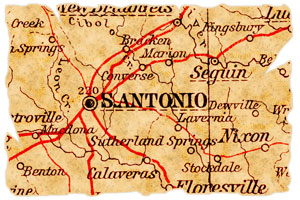
The center of San Antonio, Texas is located at about 29.42 degrees North (latitude) and 98.49 degrees West (longitude). The city occupies approximately 407.6 square miles in land area; according to the 2010 census, San Antonio's population was 1,327,407.
This San Antonio directory provides convenient access to a broad spectrum of enterprises that are located in San Antonio, Texas. In-depth information and news about San Antonio can be found on these regional San Antonio Libraries and San Antonio Newspapers pages, respectively. Visitors to San Antonio will find this San Antonio Travel and Tourism website useful.
All rights reserved.